Project carried out while working at design agency Spintank in 2024, in collaboration with Anaïs Hamel (UX).
Context
In order to showcase the wide variety of services and news from the Paris City Council, currently scattered across a multitude of dedicated sites, the Council started thinking about designing a mobile application. The idea was to centralise all this data in the most intuitive way possible, making it easier for all Parisians to access information.
Solution
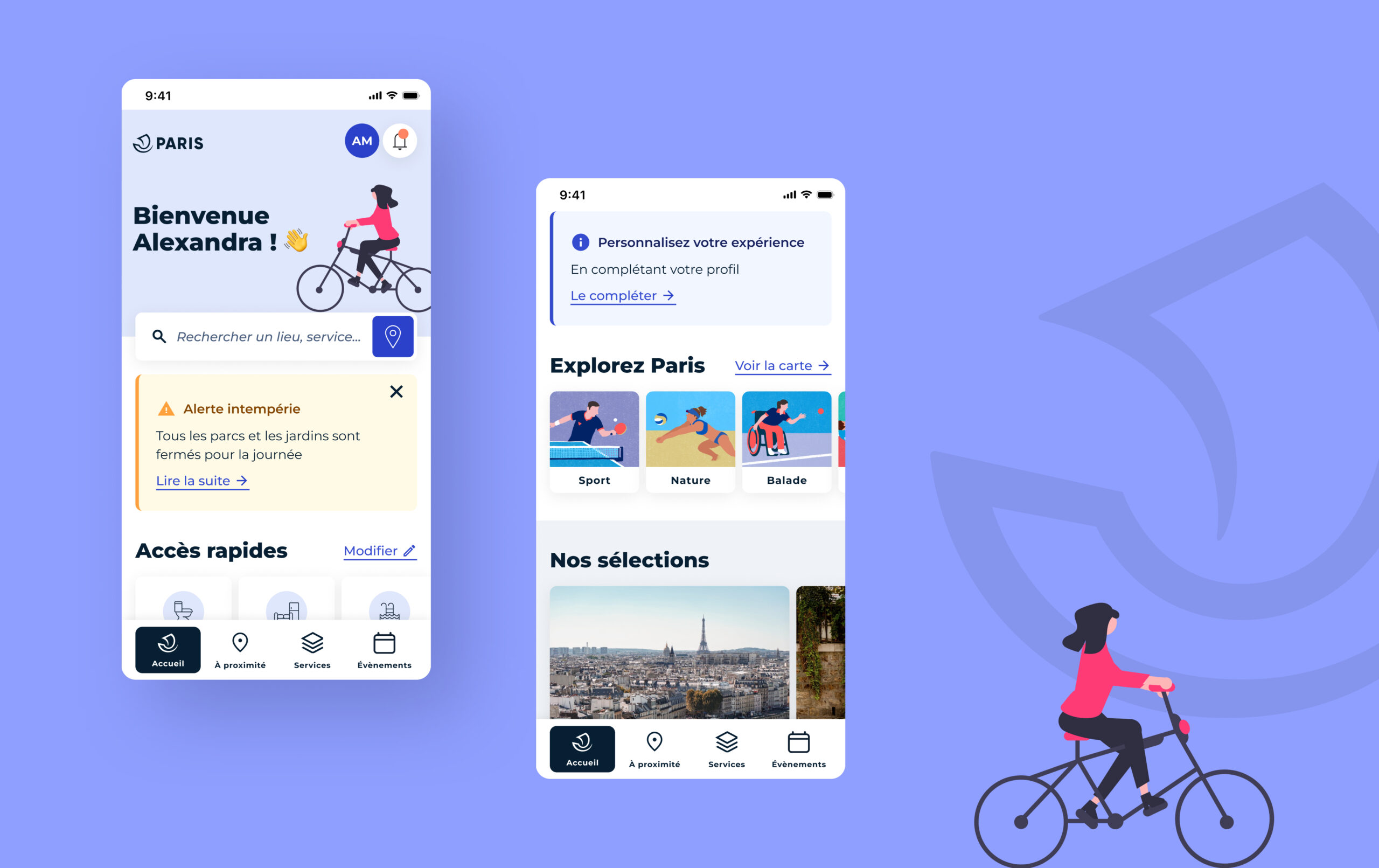
→ Paris Ma Ville: a mobile application centred around an interactive map that can be filtered and geolocated, showing local facilities and events in the City of Paris
→ Quick access, notifications and personalised event suggestions right from the homepage
→ The ability to personalise the app based on user’s interests
→ A section centralising all municipal services


The “Services” tab brings together in a digestible way all the council’s services and redirects users to dedicated websites. Informative content is also hosted on the app.

In the “Nearby” tab, users can localise municipal facilities (water fountains, toilets, sport fields, etc), find out about events and be warned of construction zones.

The interactive map features advanced filters for targeted access to specific places of interest or facilities, and encourages their discoverability. A list view of points of interest is also available, for more details.

Users can log in to their Mon Paris account or personalise the application’s alerts and suggestions.

The app’s art direction is based on the City of Paris’ design system, which has been slightly reworked to make it more pop and less formal, in particular by adding the bright, contrasting colours needed for the pictograms on the map.